Finding Us
High Wycombe is easily accessible with excellent transport links. It is about 35 miles west of London and 30 miles east of Oxford. It is a 30-minute journey from Heathrow Airport and a 90-minute journey from Gatwick Airport by road. It is less than a mile from Junction 4 of the M40.
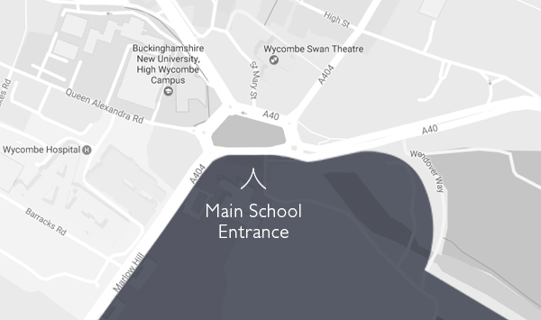
Main School Entrance
Visitors should enter the School through the main entrance which is indicated on the map below. If you are having difficulty finding us, please phone 01494 520381 for directions. If using a SatNav the School postcode/new road name may not take you to the main school entrance. Instead, please search for ‘Abbey Way, HP11’.
Or use What Three Words: blocks / blues / tile
By Road
If using a SatNav the School postcode may not take you to the main school entrance. Instead, please search for “Frances Dove Way, HP11”. Visitor parking is available on the School site.
When travelling from the M40, follow the A404 to the bottom of Marlow Hill and turn right at the first roundabout. You will then see the main entrance on your right. To avoid crossing the traffic, continue past the School to the next roundabout and take the third exit.
By Rail
There is a regular rail service from London Marylebone. You can book tickets through Chiltern Railways website found here. High Wycombe railway station is five minutes’ walk from the School. Alternatively, taxis are available outside the station.